LightChance (beta)

Photo locations · Stoos · Switzerland

Fronalpstock: sunset photography forecast

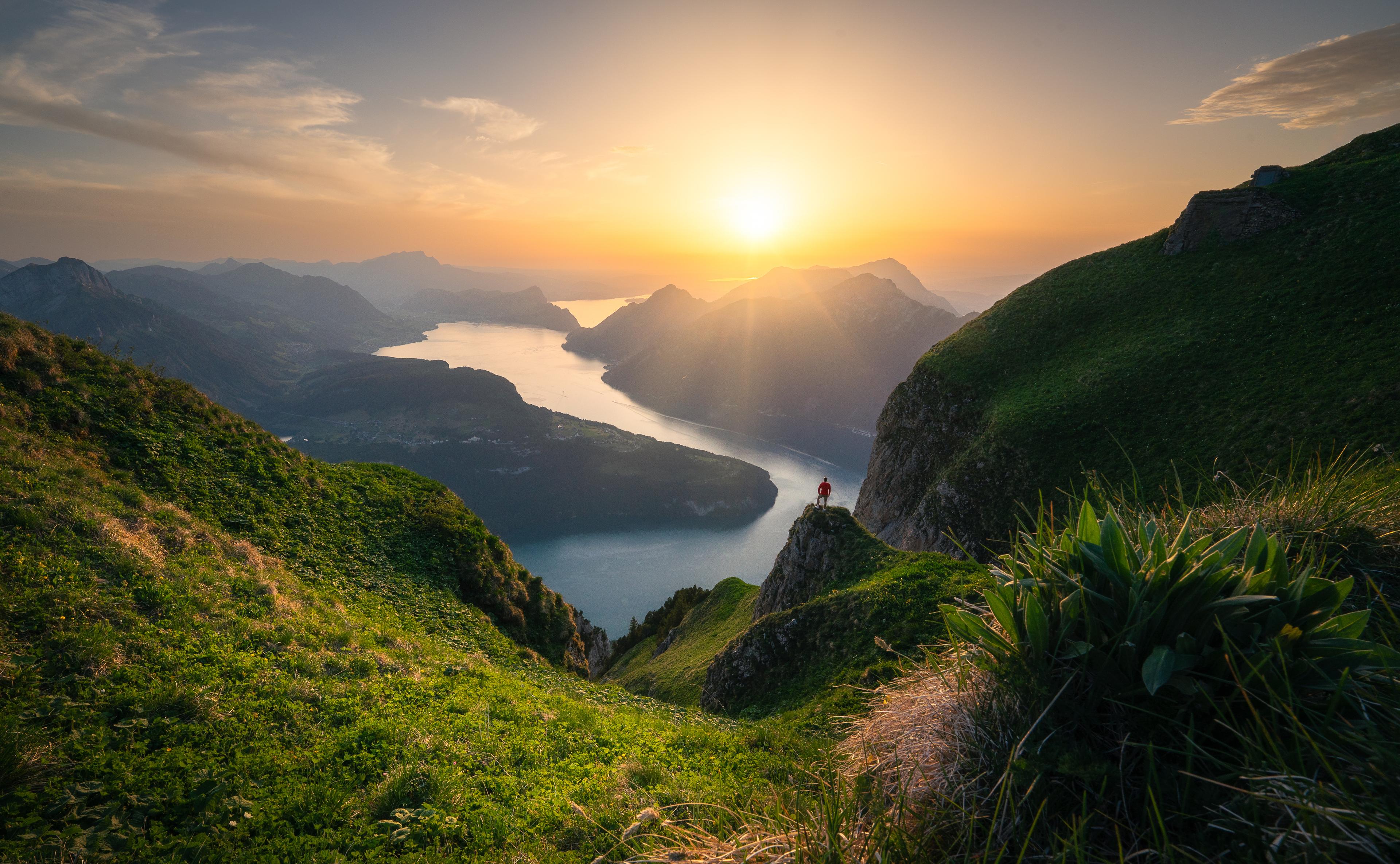
At 1,920 m the ridge above Stoos gives you Lake Lucerne folded into its side valleys and a long western horizon — the kind of open sightline that decides whether a sunset actually colours. The summit plateau is broad, so you are not fighting for one small platform.

Sunrise tomorrowSunrise TuesdaySunrise Wednesday

Will tomorrow's sunset be worth it?

Simplified forecast from the open model run. The full forecast — a second model, your exact viewpoint, the hourly cloud timeline — is in the app.

in 19h 21m

Mostly unlit cloud canvas

Starts

in 18h 34m

Diffused muted light · even light for details & forests

Sky colors

Golden hour
Sunset

Light corridor: partly open

Why: Some cloud sits along the sun's path, so light may get through only in places.

  • Light path: partly blocked (46% blocking cloud at the ray's height)
  • Sun: likely hidden. You're above the low cloud (1840 m), but a solid mid-level deck (100%) sits over it; the sun stays screened from above.
Viewer's line of sight, tangent to the Earth at your locationNear-ground relative humidity9% cover — too thin to draw as cloud13% cover — too thin to draw as cloud17% cover — too thin to draw as cloud15% cover — too thin to draw as cloud15% cover — too thin to draw as cloud19% cover — too thin to draw as cloudConnected cloud layer · 0–100% cover · 10–65% visual uncertaintyConnected cloud layer · 4–100% cover · 45–45% visual uncertaintyConnected cloud layer · 26–26% cover · 10–10% visual uncertaintyConnected cloud layer · 72–72% cover · 10–10% visual uncertaintyConnected cloud layer · 34–34% cover · 10–10% visual uncertaintyConnected cloud layer · 0–100% cover · 10–45% visual uncertaintyConnected cloud layer · 22–59% cover · 45–65% visual uncertaintyConnected cloud layer · 44–54% cover · 10–25% visual uncertaintyConnected cloud layer · 43–100% cover · 45–45% visual uncertaintyConnected cloud layer · 72–72% cover · 10–10% visual uncertaintyConnected cloud layer · 0–100% cover · 10–45% visual uncertaintyConnected cloud layer · 59–59% cover · 10–10% visual uncertaintyConnected cloud layer · 54–54% cover · 10–10% visual uncertaintyConnected cloud layer · 54–100% cover · 45–45% visual uncertaintyConnected cloud layer · 72–72% cover · 10–10% visual uncertaintyConnected cloud layer · 26–100% cover · 10–45% visual uncertaintyConnected cloud layer · 100–100% cover · 10–10% visual uncertaintyConnected cloud layer · 72–72% cover · 10–10% visual uncertaintyConnected cloud layer · 100–100% cover · 10–45% visual uncertaintyConnected cloud layer · 100–100% cover · 10–10% visual uncertaintymid cloud · 93% reported, 72% resolved on a pressure surface — 21% is somewhere between 3 and 8 kmlow cloud · 82% reported, 13% resolved on a pressure surface — 69% is somewhere between 1.84 and 3 kmlow cloud · 37% reported, 0% resolved on a pressure surface — 37% is somewhere between 1.04 and 3 kmlow cloud · 37% reported, 3% resolved on a pressure surface — 34% is somewhere between 1.56 and 3 km-5 km · the model says the lowest depicted cloud underside may catch red light0 km · the model says the lowest depicted cloud underside may catch red light · lit on one reading: the strongest cloud toward the sun was set aside, and counting it would have darkened this deck0 km · the model says the lowest depicted cloud underside may catch red light5 km · the model says the lowest depicted cloud underside may catch red light5 km · the model says the lowest depicted cloud underside may catch red light20 km · the model says the lowest depicted cloud underside may catch red light20 km · the model says the lowest depicted cloud underside may catch red light50 km · the model says the lowest depicted cloud underside may catch red light100 km · the model says the lowest depicted cloud underside may catch red light

Terrain is drawn for illustration only — it is not used to calculate underlight or obstruction.

cloud-cover fieldinterpolation uncertaintysun directionnear-ground humiditycloud at unresolved heightmodelled underlightunderlight · height uncertainunderlight · lit on one readinglit but hidden behind nearer cloud

Forecast refreshed a few hours before sunset.

Know the light
before it happens

€3.33 /month

Billed annually — €39.99

Try 14 days free

Card required, nothing charged for 14 days. Cancel any time in the trial and you pay nothing at all. EU/EEA consumers: see the right-of-withdrawal section in our Terms.

For photographers: shooting Fronalpstock

Best months

May to October, when the funicular and chairlifts run. Summer Saturdays usually add late rides, which is what makes staying for the light practical.

Suggested focal lengths

16–35 mm for the drop of the slopes against a big sky; 70–200 mm to isolate a single arm of the lake and stack the ridges behind it

Composition

Walk the plateau first. One wide frame for the whole basin, then a tighter one for whichever ridge line is catching the light.

Recommended arrival

Be on the ridge about 60 minutes before sunset, and check the last descent before you commit.

Access planning

Stoos funicular from Schwyz, then the chairlift to the summit. Confirm the evening timetable — the last downward ride is the constraint, not the walk.

Parking: Parking at the Stoos funicular valley station in Schwyz

Approach: Funicular plus chairlift; a few minutes on foot at the top

Other photo locations